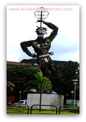
The City of Douala Cameroon
------------------- Douala-Cameroon -----------------
Douala Cameroon
Douala is the head quarters of the Wouri Division of the Littoral Region of Cameroon. It is also the largest city in the country, and the capital of the Littoral Region. It has a surface area of about 210Km2. It is located on coordinates 04°03′N 009°41′E at an elevation of 13m.
It is said to be the richest city in the CEMAC zone. In Douala, Cameroon's largest seaport and its major international airport are found. With all these facilities it is said to be the country’s economic capital.
Douala Cameroon, controls most of the country’s major exports. It has an estimated population of about 5,000,000 people. Douala sits on the estuary of the River Wouri.
When the Portuguese arrived Douala in the 15th century, the area was known as Rio dos Camarõns and before coming under German rule the town was also known in 1884 as Cameroons Town and it later became "Cameroon City", or the capital of German Kamerun. Douala was renamed in 1907 and became part of the French Cameroons in 1919. Douala is the 27th most expensive city in the world and the most expensive city in Africa.
After the independence of Cameroon, Douala has grown rapidly. Local industries, trade, and other opportunities have attracted an unprecedented influx of migrants, especially from the western region of Cameroon. People from other countries in the region have also permanently settled in the city; Douala is the first city in tropical Africa to have a piped natural gas supply. During the 18th century it was the center of transatlantic slave trade.
In 1826 Douala was made up of four different villages- Hickory-town (today Bonaberi), Akwa, Njo and Deido located in four specific locations:
Between 1940 and 1946, Douala was the capital of Cameroon.
The city is located on the banks of the Wouri River, meaning that it is a two sided city. The two sides are linked by the Wouri bridge.
Douala is divided into 7 districts-Bonabéri, Akwa, Bassa, Bonanjo, Bonapriso, Deïdo and New Bell. Douala has more than 120 neighborhoods. The Akwa district is Douala's business district and Bonanjo district is its administrative district.
Douala has a tropical monsoon climate with relatively constant temperatures throughout the course of the year. The city features warm and humid conditions with an average annual temperature of 27.0 °C, and an average humidity of 85%.
Douala sees plentiful rainfall during the course of the year, experiencing an average of 3,600 millimeters precipitation of rainfall per year.
December is the driest month in Douala with an average rainfall of 28 millimetres. Its wettest month is August with an average rainfall of 700 millimetres.
|
Douala hosts some of Cameroon's best restaurants, coffee houses and French-style patisseries. Along the waterfront, many bars and bistros may be found, commanding views of the Gulf of Guinea and nearby mangrove swamps. There are several nursery, primary, secondary, high schools and higher education institutions including the University of Douala. The Academic population is vibrant and can be noticed during rush hours. |
There is a large informal educational sector that caters for a huge part of the population. There are also a number of professionals.
Douala Cameroon has a fairly developed road network and is linked by rail to other towns like Yaoundé, Ngaoundéré, Kumba and Nkongsamba and by road to towns like Bafoussam, Buea and Bamenda.
The city is just an hour drive to the University town of Buea and the sea side town of Limbe, both in the South West Region of Cameroon.
You are on Douala Cameroon. Click here to return to our home page.
