Manyu Division
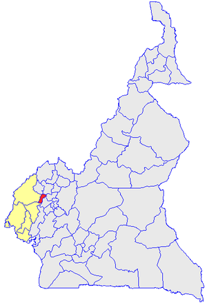
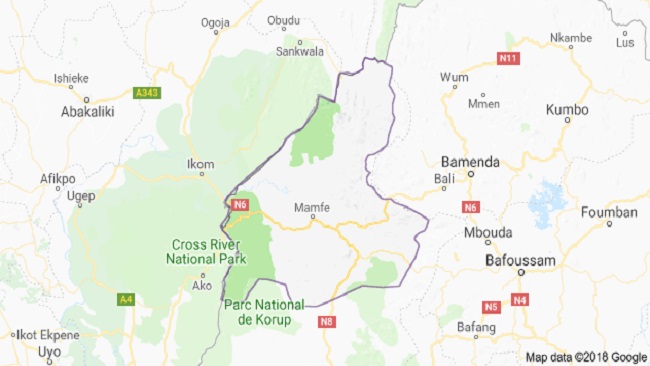
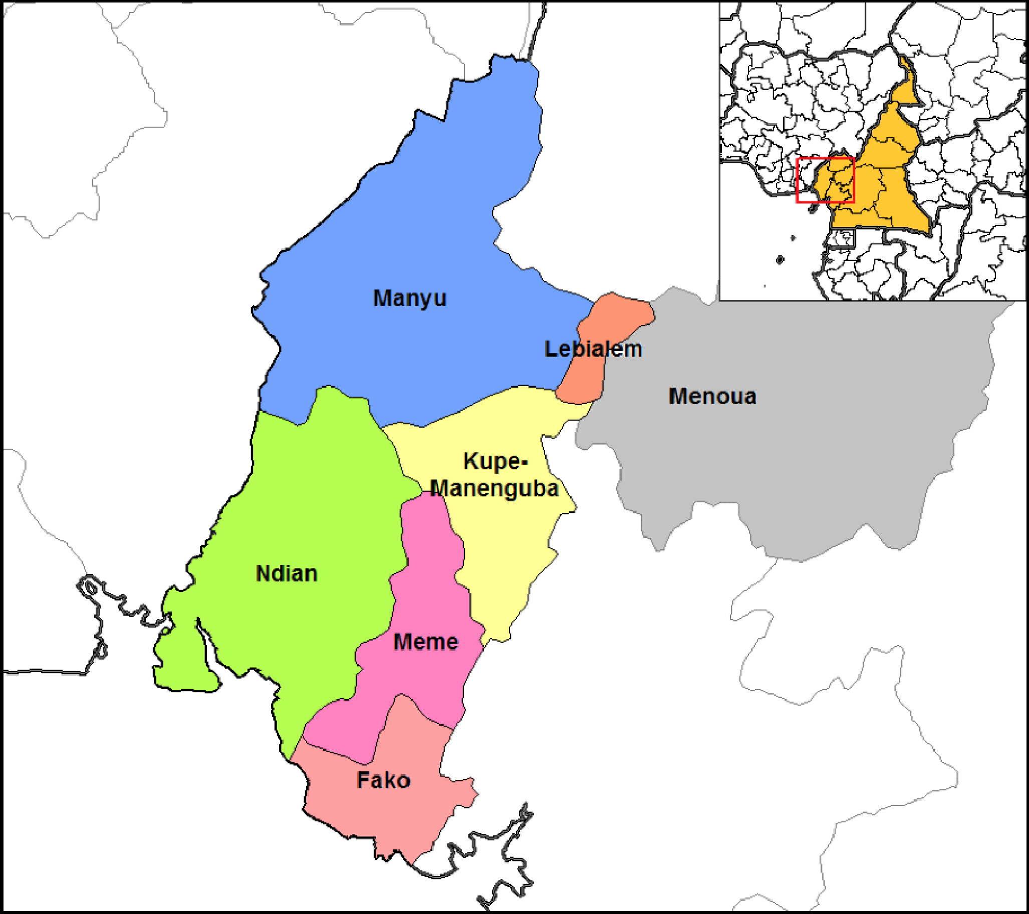
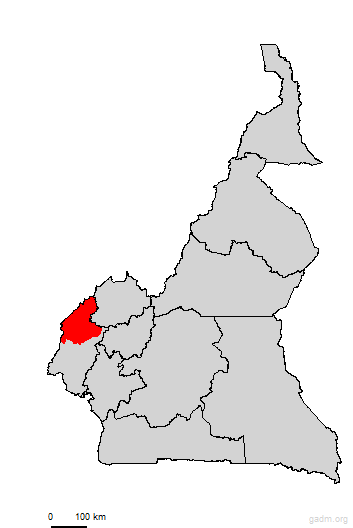
Manyu division is a department in the South West Region of Cameroon. It has as its coordinates 5.7667⁰N 9.2833⁰E. Manyu Division has a total surface area of 65, 488 km² in the four sub-divisions of Mamfe, Eyumojock, Akwaya and Upper Bayang with a total population of 177,389 inhabitants as of 2001 and approximately 181,039 inhabitants as of 2005. It shares common borders with the Widikum people to the North-East, to the South-West by the Mbo people, by Nigeria in the West and to the East by Nweh and Mundani people.
It is found in the south-western portion of the equatorial rain-forest region precisely in the Cross River Region.
Manyu, Home of the Bayangs and other Tribes
Fun Facts and Figures
|
|
 |
 |
In general, Manyu is made up of a mixture of several
tribes that inhabit the area. The domineering tribes include the Kenyangs and
Ayangs and tribes from the Northern zone such as Banso, Widikum and Bali. These
people moved into this area because of very fertile soils that encourage farming. These migrants have over over the years intermarried with the locals.
The Economy and Economic Activities
One can say without fear of contradiction that the Division is divided into three main sectors: the primary sector, secondary and tertiary sectors. The primary sector is involved in the natural resource management activities such as animal rearing, agriculture, forest exploitation and fishing. The secondary sector is defined by industrial activities and mining. Meanwhile in the tertiary sector, you find people who deal in the production of services such as banking and transportation.
There is a high exploitation of both timber and non-timber products. These products are comsumed locally and some for commercial purposes within and outside of the country. Most indigenes of this area find employment at the primary sector. Although still unexploited, it is known that the municipality has deposits of crude oil, beauxite and salt.
Education
The Manyu people of the South West Region are regarded as the most educated group of people in the country. The area is made up of numerous nursery, primary, secondary schools and training colleges. The first all-female boarding college (Queen of the Rosary Catholic College) in the country was created in the Manyu Division, precisely in Mamfe.
Religion
The main form of religious worship in this area is Christianity with main denominations including Catholics, Baptist, and Presbyterian, Apostolic, Full Gospel and many other Pentecostal churches. Islam and African Traditional religion (Animism) is also practiced in the area.
Administration
Manyu division is divided administratively into four sub-divisions which include:
1. MAMFE CENTRAL SUB-DIVISION: Mamfe Central is a sub-division which is found in the Manyu Division South West Region of the country and also the headquarters of the Manyu Division. It has as coordinates 5⁰46’N 9⁰17’E. Mamfe is about 74 km away from the Cameroon-Nigeria border. Mamfe has a total surface area of 7000 km². The population of the area as of 2017 estimate is 36,500 inhabitants with a population density of 19.78 persons/km². Mamfe is bordered to the North by Akwaya sub-division, to the South and East by Eyumojock and to the West by Tinto. The Mamfe area also has 35 Municipal council.
2. AKWAYA SUB-DIVISION: Akwaya subdivision is found in the Manyu Division in the south west region of the country. The subdivision has five court areas which include, Boki, Assumbo, Takamanda, Mbulo and Mesaga-Ekol, and 35 Municipal council. The Akwaya area has a total land surface area of 488 km² and a total population of 120,115 inhabitants with a population density of 476.64 persons/km². The subdivision is boredered to the North West by Menchum Division and Momo Division, to the south by Mamfe central subdivision. To the east by Eyumojock subdivision and to the west by Upper Bayang subdivision. The area has about 99 gazetted villages. During the rainy season, the roads become very difficult to access by foot and access to the area is mostly by foot from Mamfe and by vehicles through Nigeria.
3. EYUMOJOCK SUB-DIVISION: Eyumojock, which is also spelled Eyumojok or Eyumodjock is a town, a commune and a sub-division in the Manyu Division. It extends from Latitude 50 10’9’’ to 50 50’7’’ North of the Equator and Longitude 80 50’100’’ to 90 20’5’’ East of the Greenwhich Meridian. Eyumojock was created in the year 1984 and is made of 25 Municipal councils. The Eyumojock area has a total surface area of 3,442 km², with a total population of approximately 46,771 inhabitants and a population density of 13.58 persons/km². Eyumojock is situated about 45 km from Mamfe, and approximately 300km from Buea the capital of South West. The Municipality is found roughly between the towns of Ikom in Nigeria and Mamfe. The Eyumojock area shares it boundaries to the North with, Akwaya sub-division, to the south by Mundemba and Tiko, to the West by the Federal Republic of Nigeria and to the East by Upper Bayang and Mamfe Central sub-division.
4. UPPER BAYANG SUB-DIVISION: Upper Bayang sub-division which was created by the presidential decree in the year 1992 and the Tinto council was created later on by presidential decree N⁰ 93/321 of November in the year 1993, even though it went operational only in 1996. The Upper Bayang sub-division is found in the heart of a dense tropical rain forest. This dense tropical rain forest has attracted forest exploiters, Non Timber Product harvesters and ecotourism. Upper Bayang sub-division is bordered to the North by Widikum and Mamfe Central, to the South by Nguti, Menji and Eyumojock.
Manyu Groups
Sons and daughters of this part of the country can be found all over the world. As such, they have organised themselves into groups and associations where ever they find themselves. Below are some Associations.
MECA Germany
MECA DC, USA
Have A Great Story About This Place?
Are you from Manyu? Have you lived there before? Dou you currently live there? And, do you have a great story about this place? Share it!
Hope you really enjoyed this page on Manyu. Click here to return to our Home Page
Further Readings?
Do you want more information? Visit these websites.
