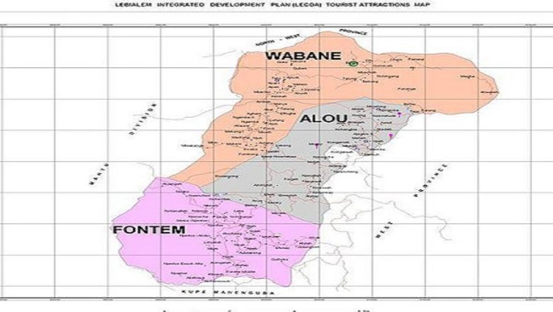
Alou Sub Division
Alou Sub Division is one of the three sub divisions that make up the Lebialem Division of the South West Region of Cameroon.
It is bounded to the south by Fontem sub-division, to the North by Wabane sub-division, to the East by Manyu Division of the South West Region and to the West by the Menoua Division. Alou has a total surface area of 705.63km², with a total population of 59,793 inhabitants and a density of 84.73 persons/km².
Alou Sub-Division was created by decree N⁰ 94/010 on the 12 of January 1994 which gave way for the people of Alou to benefit the status of rural council legalized by decree N⁰ 95/085 on the 24th of April 1995 with 31 municipal councilorss. Alou urban space comprise of 14 villages made of two main fondoms which are Nwametaw Fondom (which starts from its palace and extend across Nchenallah Nqwuin village and Nwasah village towards the main market), and Ndungatet Fondom whose urban space stretches from Foto’s palace through Sandsan quarter, Atululi and three-corners Alou to the main market.

History
Oral history has it that, humans have inhabited the area for the past two centuries. The inhabitants of the area originated from different places. Majority of the inhabitants of Lower lewoh are said to have originated from Bayangi in the upper Bayang sub-division of Manyu Division.
The inhabitants of Upper lewoh, Njenawung, Ndungatet and Nwametaw hold their origin to the Dschang people of the West region and share a common culture with the Bamileke people of Menoua Division and the M’mock people are said to have migrated from the Wabanes influence mostly by the availability of fertile soils for agriculture. Over time, much has change leading to the development of six major existing chiefdoms of Lewoh, Nwametaw, Ndungatet, Njenawung, M’mockngie and M’mockmbie.
Ethnic Groups and Languages
The main dialect spoken in this area is the Nweh dialect spoken by 6 fondoms of Lewoh, Nwametah, Ndungatet, M’mockngie, M’mockmbie and Nwengong. The Lewoh people among the chiefdoms typically speak the Nweh dialect, The M’mockmbie and M’mockngie people speak the mundani dialect and the Ndungatet, Nwengong and Nwametaw have similar accent with the Bamilekes of the Menoua Division. The minority of the population of Lower Lewoh and Njenatah speak Bayangi due to their closeness and intermarriages between the upper Bayang of the Manyu Division.
Climate, Relief and Vegetation and Fauna
The area experiences both the rainy season and the dry season. The rainy season starts in mid-march and extends right up to October and sometimes in November with an average annual rainfall of about 1400mm-1800mm while the dry season begins in November and ends in March. Due to climate change, it is becoming more difficult to predict the seasons as it keeps fluctuating.
Most areas in Alou Sub-Division are very cold accompanied by dense fog locally known by the inhabitants as “Aluo” with temperatures which vary between 180⁰c-300⁰c. The coldness is due to the altitude which ranges from 1611m around three-corner Ndungatet to about 1900m in Mbelenka. It is believed that the name Alou is derived from the foggy nature of the area locally referred to as “Aluo”.
Relief
The area comprise of hills with broad-shaped tops, also characterised by truncated V-shaped valleys with small rivers. The area is generally hilly and undulating especially in the south west of the area. It rises from an altitude of 450m from Ndumbin, through 1611m at Ndungatet and Nwametaw to over 2100m in the Mbelenka area.
Soils
There is a variation in soils due to the difference in topography and vegetation. The soils in Lower part of Effong, Njenawung, Ndun nwa and part of M’mockmbie are reddish, rocky and gravely with a 5-10cm organic matter. The availability of many eucalyptus trees in the area has rendered the soils infertile. The soils in M’mockmbie and M’mockngie support the cultivation of vegetable crops like Irish potatoes, cabbage, carrots, and leeks due to deeper soils which are slightly acidic with PH of 4.87-6.64 and higher nitrogen.
Vegetation (Flora)
Two main vegetation types are found. The tropical savanna vegetation found in Anya Menkey, Atullah andNembat villages of upper Lewoh, the Ever green forest which covers the lower zones of Njenatah, Effong, Atem, Attrah, Keleng and Alou.
Fauna
Variation in vegetation has given rise to a variety of animal species. Antelopes and monkeys dominate the lower forest zone. While in the upper savannah zones, moles and rats are dominant. Birds, insects and reptiles are also found in both zones.
Economic Activities
Most people in this area are farmers with average income of 30,000 FCFA. Agricultural practices in this area is very intense especially around the M’mock zone where there is a high cultivation of vegetable crops like leeks, Irish potato, cabbages and carrot, which are sold in their local markets and the neighbouring towns of Dschang, Kumba and Douala. Aside from farming, the inhabitants are also involved in hunting, fishing, quarrying building and construction.
Religion
Majority of the population are Christians with the Catholics being the dominant denomination since they are said to be the first settlers like Saint John Catholic church Fotabong, before other religions. This is followed by the protestant denomination mostly the Presbyterians. Other minority religious bodies include the Apostolic and Full Gospel mission. These churches congregate mostly in Lewoh and M’mouck Fossimondi.
Hope you love this page on Alou. Click here to return to our Home page
Click Here for Further Readings